셰필드 근처의 촬영지
도심에서 100km 이내에 있으며 영화와 텔레비전 시리즈가 촬영된 461곳: 하나하나가 인터랙티브 지도 위에 있고, 사진과 거리와 그곳에서 촬영된 것이 함께 있다. 가장 가까운 곳은 Sheffield Town Hall로 남동으로 1 km이고, 가장 많이 촬영된 곳은 맨체스터 (Manchester)로 기록된 16편이다.
근처의 특정 지점이 아니라 셰필드 자체에 기록된 모든 것은 그 자체 페이지에 있다.
100km 이내 · 461 235 마을과 도시 · 130 명소, 건물과 내부 공간 · 43 풍경, 해안과 황야 · 34 성, 궁전과 대저택 가장 가까운 곳 · Sheffield Town Hall · 1 km 가장 유명한 곳 · 맨체스터 (Manchester)
셰필드에서 25km 이내
-
 명소와 건물
Sheffield Town Hall
 잉글랜드 · 1 km 남동 · 1편, Wikipedia에 따름
Grade I listed seat of local government in Sheffield, South Yorkshire, England, UK
-
 명소와 건물
National Union of Mineworkers headquarters
잉글랜드 · 1 km 서 · 1편, Wikipedia에 따름
Building in Sheffield, England
-
 마을과 도시
Park Hill
잉글랜드 · 1 km 동 · 1편, Wikipedia에 따름
Housing estate and area of Sheffield, in South Yorkshire, England, UK
-
 명소와 건물
브래몰 레인
잉글랜드 · 1 km 남 · 1편, Wikipedia에 따름
Football stadium
-
 명소와 건물
Neepsend railway station
잉글랜드 · 2 km 북서 · 1편, Wikipedia에 따름
Railway station in South Yorkshire, England, UK, now closed
-
 명소와 건물
Sandygate Road
잉글랜드 · 4 km 서 · 1편, Wikipedia에 따름
Football and cricket stadium Crosspool, South Yorkshire, England
-
 명소와 건물
Millmoor
잉글랜드 · 8 km 북동 · 1편, Wikipedia에 따름
Stadium in Rotherham, England
-
 마을과 도시
로더럼
잉글랜드 · 9 km 북동 · 4편, Wikipedia에 따름
Town in South Yorkshire, England
-
 명소와 건물
Rotherham Interchange
잉글랜드 · 10 km 북동 · 1편, Wikipedia에 따름
Bus station in Rotherham, South Yorkshire, England
-
 풍경과 자연
Burbage Rocks
잉글랜드 · 10 km 남서 · 1편, Wikipedia에 따름
Hill in the English Peak District
-
 풍경과 자연
Carl Wark
잉글랜드 · 11 km 남서 · 1편, Wikipedia에 따름
Promontory in Sheffield, South Yorkshire, England, UK
-
 성과 궁전
Wentworth Woodhouse
잉글랜드 · 11 km 북동 · 7편, Wikipedia에 따름
Country house in the village of Wentworth, South Yorkshire, England, UK
12개 중 9개
+ 이 범위에 35개 더: 모두 인터랙티브 지도에 있다.
당일치기: 25~60km
-
 마을과 도시
Darley Dale
잉글랜드 · 25 km 남 · 1편
Town and civil parish in Derbyshire Dales district, Derbyshire, England
-
 마을과 도시
하이피크
잉글랜드 · 25 km 서 · 1편, Wikipedia에 따름
Borough in Derbyshire, England, UK
-
 마을과 도시
셔브룩 (Shirebrook)
잉글랜드 · 26 km 남동 · 1편, Wikipedia에 따름
Town and civil parish in the Bolsover District of Derbyshire, England
-
 마을과 도시
South Kirkby and Moorthorpe
잉글랜드 · 26 km 북동 · 1편, Wikipedia에 따름
Town in Wakefield, West Yorkshire, United Kingdom
-
 마을과 도시
South Kirkby
잉글랜드 · 26 km 북동 · 1편, Wikipedia에 따름
Town in West Yorkshire, United Kingdom
-
 풍경과 자연
Peak District
잉글랜드 · 27 km 서 · 11편, Wikipedia에 따름
Upland area in central and northern England
-
 마을과 도시
사우스 엠살
잉글랜드 · 27 km 북동 · 1편, Wikipedia에 따름
Town and civil parish in West Yorkshire, England, UK
-
 명소와 건물
Minsthorpe Community College
잉글랜드 · 27 km 북동 · 1편, Wikipedia에 따름
School in Wakefield, UK
-
 마을과 도시
동커스터
잉글랜드 · 27 km 북동 · 1편
City in South Yorkshire, England, UK
-
 명소와 건물
Doncaster College
잉글랜드 · 28 km 북동 · 1편, Wikipedia에 따름
School in Doncaster, South Yorkshire, England
-
 풍경과 자연
Robin Hood's Stride
잉글랜드 · 28 km 남서 · 1편, Wikipedia에 따름
Rock formation in Derbyshire, England
-
 풍경과 자연
Cales Dale
잉글랜드 · 28 km 남서 · 1편, Wikipedia에 따름
Valley in the Derbyshire Peak District
12개 중 9개
+ 이 범위에 193개 더: 모두 인터랙티브 지도에 있다.
더 먼 곳: 60~100km
-
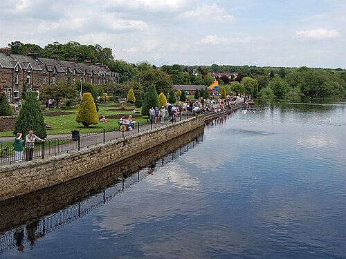 마을과 도시
오틀리
잉글랜드 · 60 km 북 · 5편, Wikipedia에 따름
Market town and civil parish in the City of Leeds metropolitan borough, West Yorkshire, England
-
 마을과 도시
Bacup
잉글랜드 · 60 km 북서 · 2편, Wikipedia에 따름
Town in Lancashire, England
-
 마을과 도시
래드클리프
잉글랜드 · 60 km 서 · 1편, Wikipedia에 따름
Town in the metropolitan borough of Bury, Greater Manchester, England
-
 명소와 건물
Repton School
잉글랜드 · 60 km 남 · 1편, Wikipedia에 따름
영국의 초등학교
-
 마을과 도시
Urmston
잉글랜드 · 60 km 서 · 1편, Wikipedia에 따름
Town in Trafford, Greater Manchester, England
-
 마을과 도시
너스포드
잉글랜드 · 60 km 서 · 1편
Town in Cheshire, England, United Kingdom
-
 마을과 도시
렙톤
잉글랜드 · 61 km 남 · 1편, Wikipedia에 따름
Village in Derbyshire, England, UK
-
 마을과 도시
Oakworth
잉글랜드 · 61 km 북서 · 1편, Wikipedia에 따름
Village in West Yorkshire, UK
-
 마을과 도시
Flixton
잉글랜드 · 61 km 서 · 1편, Wikipedia에 따름
Village in the Metropolitan Borough of Trafford, Greater Manchester, England
-
 성과 궁전
Tatton Hall
잉글랜드 · 61 km 서 · 1편, Wikipedia에 따름
Grade I listed historic house museum in Cheshire East, United Kingdom
-
 마을과 도시
웨더비
잉글랜드 · 61 km 북 · 2편, Wikipedia에 따름
Town in West Yorkshire, UK
-
 명소와 건물
Wetherby Town Hall
잉글랜드 · 61 km 북 · 1편, Wikipedia에 따름
Community building in Wetherby, West Yorkshire, England, UK
12개 중 9개
+ 이 범위에 197개 더: 모두 인터랙티브 지도에 있다.
근처 도시 가이드
리즈 · 47 km 맨체스터, 영국 · 51 km 볼턴 · 67 km 레스터 · 86 km 버밍엄, 영국 · 104 km
자주 묻는 질문
셰필드에서 100km 이내에 촬영지가 몇 곳 있는가?
461, 그중 그중 47은 도심에서 25 km 이내에 있다. 모두 인터랙티브 지도에 나와 있다.
셰필드에서 가장 가까운 촬영지는 어디인가?
Sheffield Town Hall, 중심에서 남동으로 1 km.
셰필드 근처에서 가장 많은 작품이 촬영된 촬영지는 어디인가?
맨체스터 (Manchester), 기록된 16편, 중심에서 서으로 53 km.
셰필드 근처에서 가장 잘 알려진 장소는 어디인가?
맨체스터 (Manchester), 중심에서 53 km, Wikipedia 185개 언어판에 실려 있다.